Following our earlier hike in Busan to Seokbul-sa (Seokbul Temple, 석불사), we went for another ramble in the mountains. Once again, we plotted our own trail for a half-day walk in the woods so that we could sleep a little longer.
By the way, Google Maps is not used much by people in South Korea where the local equivalent, Naver Map, is preferred. Which means that many places that are not marked on Google Maps nor can you readily find directions to them. Hence, the map links in this article will bring you to Naver Map for easy navigation should you wish to try this route.
We headed to Mount Baekyang (Baekyang-san, 백양산) as it’s accessible by subway from our apartment in Seomyeon and there are multiple trails and notable temples on it. After arriving at Gunam station (구남역), we got a snack at Paris Baguette – which, despite its name, is actually a South Korean bakery chain. From there, we walked to Gwaneum Temple (Gwaneum-sa, 관음사).
Tucked amidst high-rise residential towers and cherry trees, the temple marks one of several entry points to an elevated walkway built into the mountainside. This barrier-free boardwalk makes the mountain accessible to people of all ages, including young children and those in wheelchairs.

We eventually branched off onto dirt trails which we find more enjoyable to walk on. As we marched on, every now and then, we would spot the endless walls of concrete blocks and massive highways in the distance set amidst mountain peaks and pockets of water bodies.

With AB leading the way, I simply followed him as he occasionally referred to OpenStreetMap. This is a good alternative for navigation in Korea – as well as around the world. Free to use, it is built on open-source software and updated by a global user network with no crafty cookie crumbs.

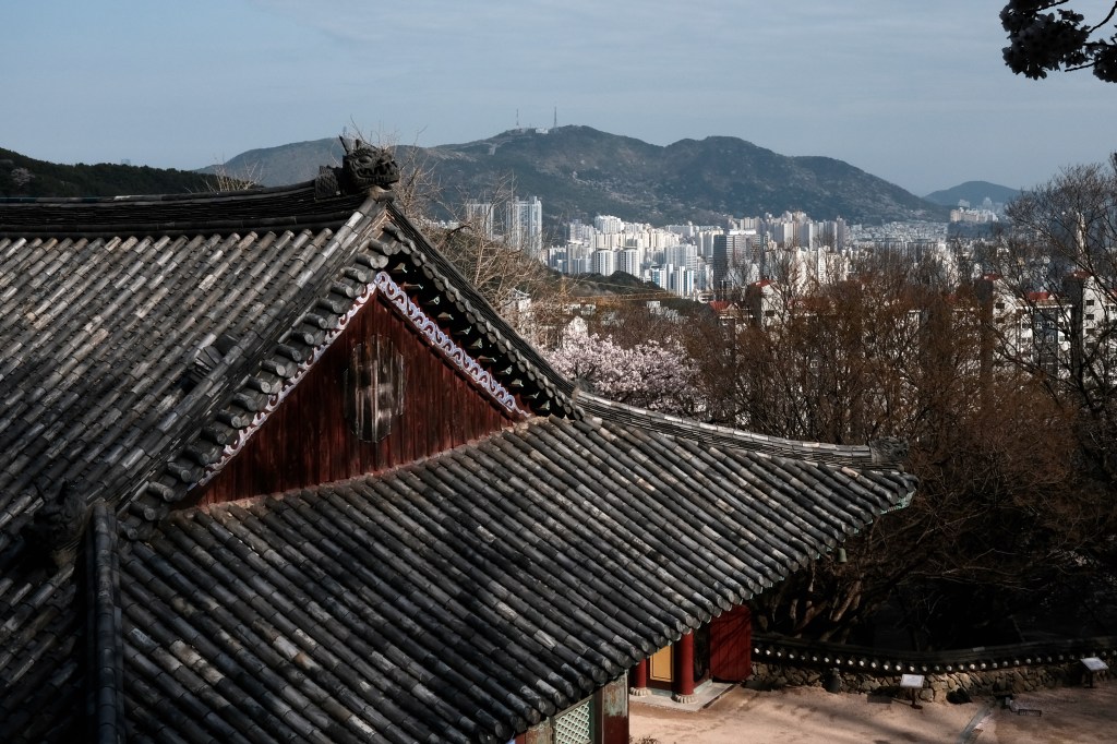
We eventually arrived at Unsu-sa (Unsu Temple, 운수사; Naver Map) which is west of the peaks of Baekyangsan. Like Seokbul-sa, Unsu-sa is a branch of the renowned Beomeo-sa ( Beomeo Temple, 범어사). Historical and archaeological records show that this was one of the larger temples – alongside Beomeo-sa, Seonam-sa, Maha-sa – in this corner of the peninsula.
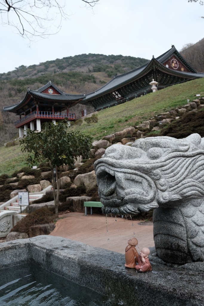
The temple’s name means “Cloud Water Temple” in English. From its lofty perch, one could glimpse the distant sea from the wooden pavilion in front of the historic Daeungjeon Hall. At the bottom of the temple, people were collecting UV-treated water by the jerrycan from the mountain stream. A nearby sign described this as “precious” and “mysterious water.” Not wanting to miss out, I tossed aside my concerns of E. coli and the remaining liquid in my bottle to try some.
There are 108 steps leading to the viewing pavilion. Each step bears words of wisdom. Thanks to Google Translate, none of it was lost of me, though some may have been slightly lost in translation. For instance: “Only fair people are allowed to be adults.” Having had a recent dental surgery where I bid farewell to yet another tooth, I chuckled at the metaphor of how “just as the gums cope with the absence of teeth, there are ways to cope.” A divine message for me, perhaps.

We continued on our way, choosing an elevated dirt trail over a paved road. Instead of continuing to the peak of Baekyang-san, we wandered off to another cool panoramic viewing spot.

Before heading back down into the city, we figured we would stop by Seonam-sa (Seonam Temple, 선암사), another prominent temple on Mount Baekyang.
Not want to make a significant detour to follow a marked route, we decided to take what looked like a more direct path on OpenStreetMap from where we were at to Seonam-sa. This turned out to be the most challenging part of our hike!
The ground was covered with small loose rocks and dead leaves that had gotten mushy and slippery from the previous day’s rain. We would spend the next one hour climbing down those unmarked slopes while using OpenStreetMap to guide us in the general direction where Seonam-sa stands.

I found a broken branch with a forked end which turned out to be an excellent support for this downhill descent. The small Y-tip fitted perfectly around the narrow tree trunks, providing me with just enough grip and bolstering my confidence as we made our way down through the blur of silvery trees.
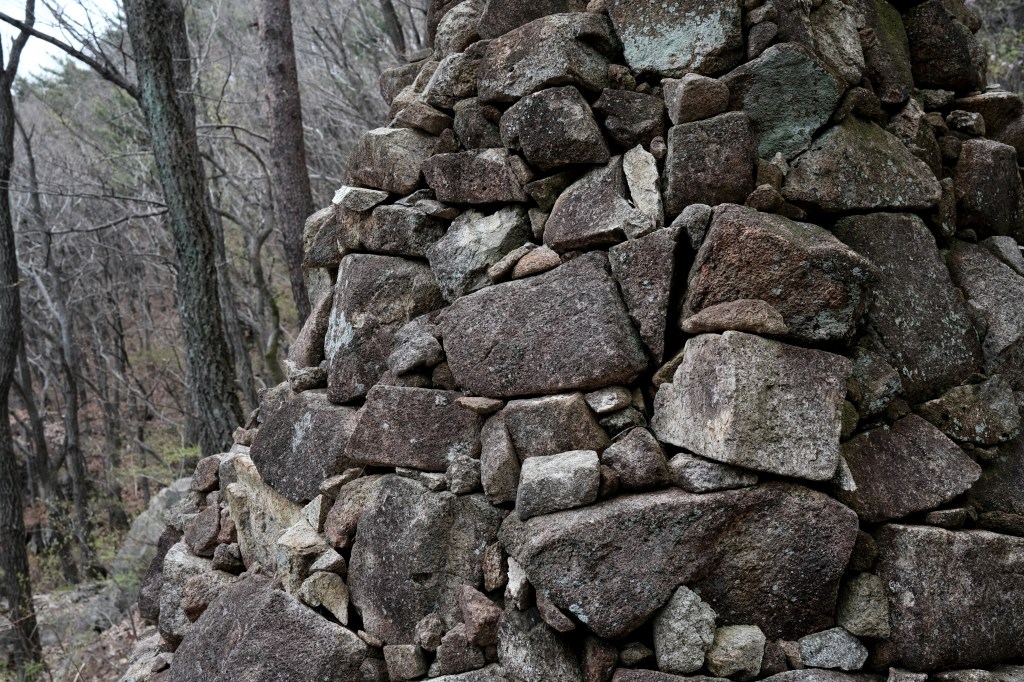
We eventually came upon a clearing with columns of stacked stones. There was an unworldly atmosphere with so many of these standing in neat rows looking out to the city in the distance. They seemed human-like, frozen in grey rock forms.

I caught up with AB who was already taking a rest and seated amongst them. Either because I was exhausted or afraid, I mused in a low voice if there were tombstones.
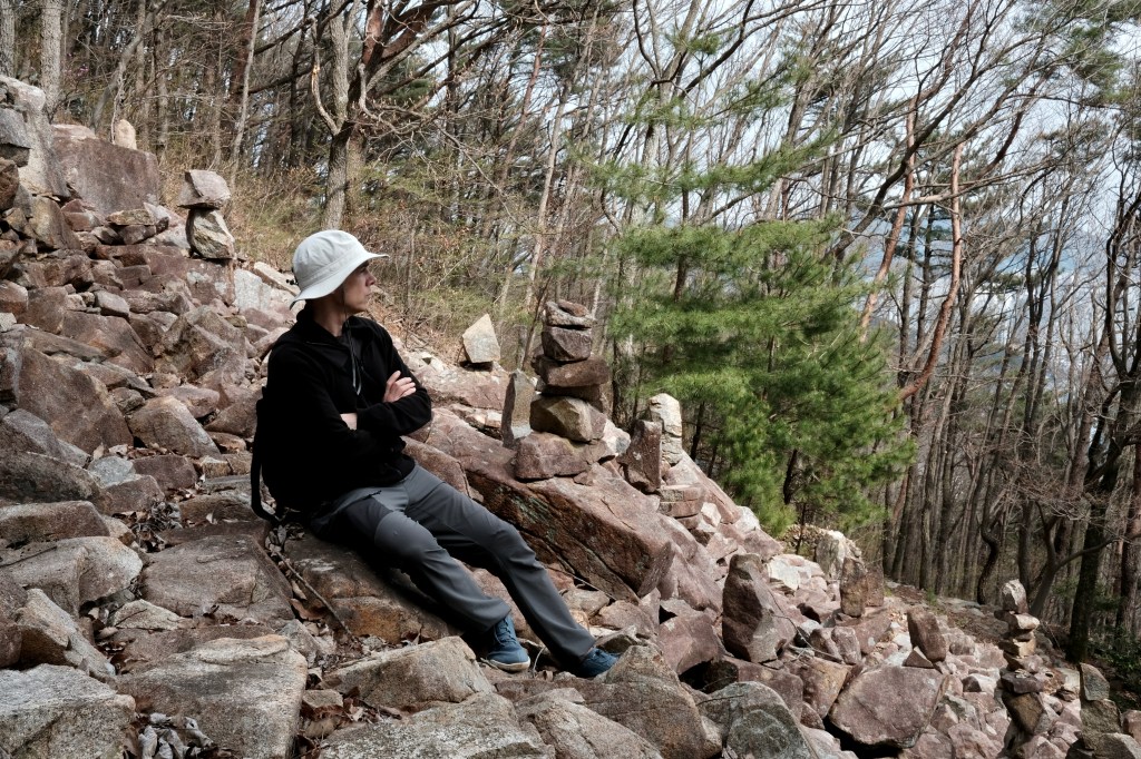
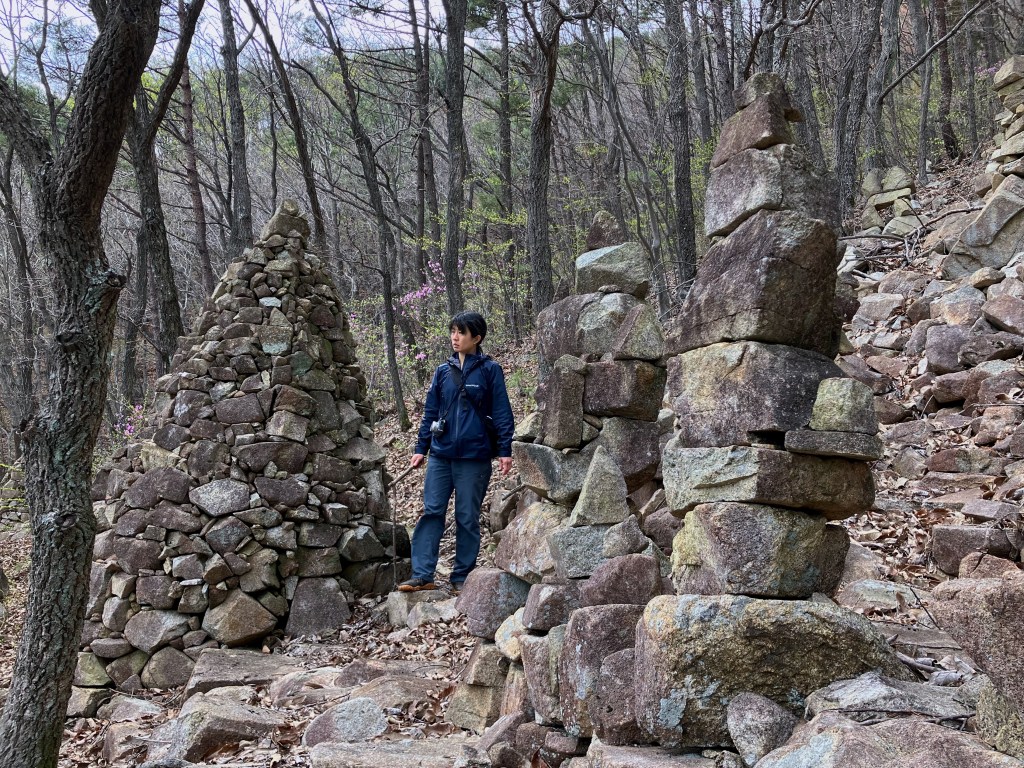
As we continued on our way, Seonam-sa emerged from beyond the trees, mere minutes beyond this sea of stacked stones. It later occurred to me that the cairns were probably part of meditation exercises led by the temple. Phew.

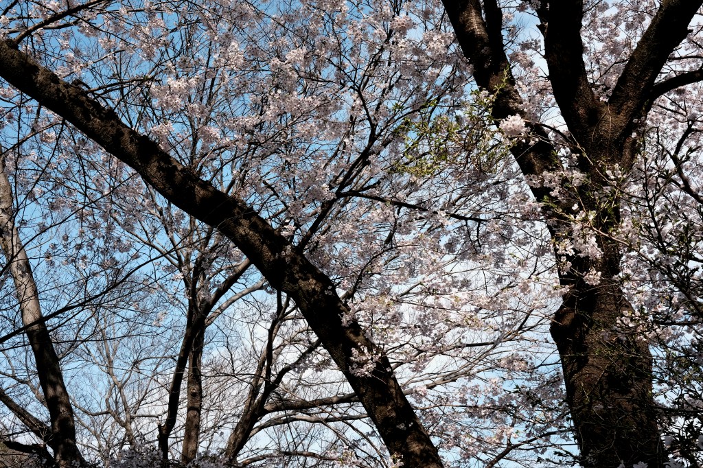
Exhausted by the laborious descent, I was grateful to rest my sore knees as I sat on a bench beneath a cherry tree. The peaceful grounds of the temple were lined with cherry trees, heavy with pink and white flowers and swaying in the gentle breeze. When the wind blew, pale petals drifted like snowflakes around me before settling on the ground. Somewhat dazed from fatigue and amazement, it all felt surreal.

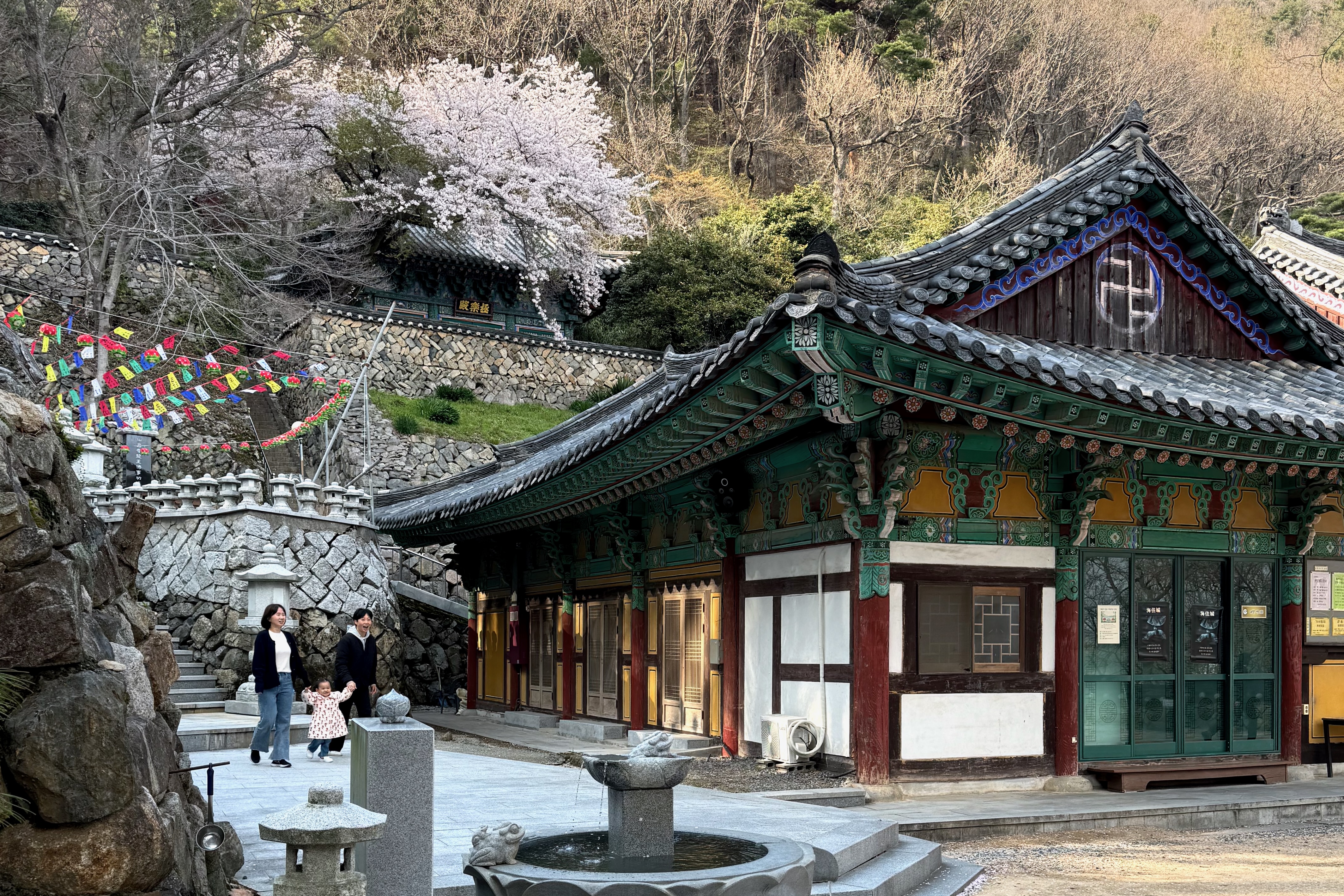
I didn’t budge for the next 10 minutes as AB explored around the temple. Other people came and went, taking photos and strolling about. All of them arrived at the temple via much less arduous means than us as you can easily get here by car or taking some stairs.


Descending the steps, we soon arrived at a bus stop. We took a ride to Samselang 삼세랑 for tasty and healthy bibimbap, which I readily finished after our adventure in the mountains.

Hike summary: This hike took around four and a half hours, of which about a quarter was spent on the steep descent through unmarked woods to Seonam-sa. The climb down included a detour that had us retracing our steps on the mountain slope.


Leave a reply to Chinaman Creek Cancel reply